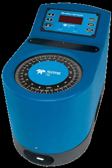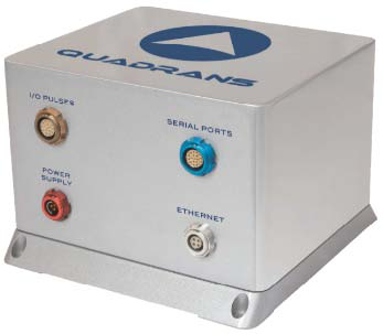
应用 • 调查船、作业船 • 商业运输、游艇 • 水面船只、快速渡轮 • Survey Vessels- Workboats • Commercial Shipping- Yachts • Surface Vessels- Fast Ferries | 特点 • 高动态艏向精度 • 通用的中继器和辅助服务提供的范围 • Fast initial settle time • Small, lightweight and versatile | 技术参数 • 艏向精度0.05°(静态) 0.20°(动态) • 定点误差 0.10° • 定点重复性 0.10° • 角速率 ~200°/s |
QUADRANS

应用 • 地震、海洋工程、作业船、拖轮 • 钻井船、渔业、调查船、DP船 • Seismic - Marine construction - Workboats - Tugs • Drilling ships - Fishing - Survey vessels - DP operating vessels | 特点 • 即插即用 • 快速设定时间 • 免维护 • 易于集成 • 高可靠性 • Plug and play • Fast-setting time • Maintenance-free • Easy integration • High-reliability | 技术参数 • 艏向精度0.23° • 横摇/纵倾精度 0.1° • 设定时间<30分钟 • 操作范围艏向 0°至360° 横摇 ±180° 纵倾±90° |
OCTANS3000
| ROVINS
|
应用 • ROV和海上调查 • 多波束和声纳运动参考 • 挖沟 • 海洋建造 • ROV and offshore survey • MBES and sonar motion reference • Dredging • Marine construction 特点 • 高性能实时输出真实的艏向、横摇、纵倾、升沉、纵荡、横荡、加速度和速率 • 外壳轻便耐腐蚀 • 易于集成和连接,节省宝贵的动员时间 • 使用简单的软件升级即可获得INS-class系统 • High-performance real-time outputs of true heading, roll, pitch, heave, surge, sway, acceleration and rate of turn • Lightweight corrosion free housing • Easy to integrate and interface, saves valuable mobilization time • Obtain INS-class system with simple software upgrade 技术参数 • 额定深度3000米 • 升沉精度2.5厘米 or 2.5% • 艏向精度0.1°,艏向分辨率0.01° • 横摇/纵倾动态精度 0.01°,横摇/纵倾分辨率0.001° • 设定时间< 5 分钟 | 应用 • ROV/AUV 定位 • 多波束和声纳运动参考 • 海底建造 • ROV/AUV positioning • Multibeam sonar motion reference • Subsea construction 特点 • 一体化三维定位,包括艏向、横摇、纵倾、升沉 • 光纤陀螺仪(FOG),独特的捷联技术 • 多种辅助选项(DVL,USBL,LBL,RAMSES,GPS,深度传感器) • 对所有水下运载器提供高精度的地理参考位置和姿态 • All-in-one 3D positioning with heading, roll, pitch and heave • Fiber-Optic Gyroscope (FOG), unique strap-down technology • Multiple aiding options (DVL, USBL, LBL, RAMSES, GPS, depth sensor) • Accurate georeferenced position and attitude for all subsea vehicles at high 频率 技术参数 • 额定深度3000米 • 升沉精度2.5厘米或2.5% • 横摇/纵倾精度为0.01° • 艏向精度:使用GPS/USBL/LBL/DVL时,为0.05° • 定位精度:使用USBL/LBL时,为USBL/LBL精度的3倍; 使用DVL时,为行进距离的0.2% |
Lodestar AHRS
| ||
应用 • 优化的USBL系统 • 作为精确的位置输入DP系统 • 作为ROV的定位系统 • 多波束调查 • An optimised USBL system. • As a precise position input to DP systems. • As a positioning system for an ROV. • Multi-beam Surveys. | 特点 • 用于姿态传感器,电罗经和AAINS系统的单箱解决方案 • 额定深度的选择:1000米、3000米或5000米 • 也可作为水面罗经使用 • AAINS功能可用 • Single box solution for motion sensor, gyrocompass and AAINS systems. • Choice of depth ratings: 1,000m, 3,000m and 5,000m • Surface version available • AAINS capability | 技术参数 • 艏向:范围0-360º 精度 0.1° 设定时间<5分钟 追踪速度500°/秒 分辨率0.01° • 横摇/纵倾:范围±180º 精度0.01º 分辨率0.01º • 升沉:范围±99 m 精度5 cm or 5% 分辨率0.01米 |
Mobius_F
| ||
应用 • ROV/AUV 定位 • 多波束和声纳运动参考 • 海底建造 • ROV/AUV positioning • Multibeam sonar motion reference • Subsea construction | 特点 • 占用空间小 • 光纤陀螺仪(FOG),独特的捷联技术 • 多种辅助选项(DVL,USBL,LBL,RAMSES,GPS,深度传感器) • 对所有水下运载器提供高精度的地理参考位置和姿态 • Small Footprint • Ranging and Telemetry • Fibre Optic Gyro Technology – No Moving Parts • Fast North Seeking • Speed of Sound Measurement: Valeport Minisvs • 24 Hour Battery Life on Single Charge | 技术参数 • 额定深度3000米 • 升沉精度2.5厘米或2.5% • 横摇/纵倾精度为0.01° • 艏向精度:使用GPS/USBL/LBL/DVL时,为0.05° • 定位精度:使用USBL/LBL时,为USBL/LBL精度的3倍; 使用DVL时,为行进距离的0.2% |